Date of visit: July 2017
When either time or cash (or often both) are in short supply there is nothing like a mini adventure to inject a little excitement into the humdrum of your day to day life. So, with a warm July weekend looming on the horizon when our friend Mark suggested an impromptu day of trekking in the Peak District we jumped at the chance! (Planning anything around the weather is notoriously difficult in England…)
We live a 3 hour drive from the Peak District which sits in the heart of England’s Derbyshire and as this is just about doable in a day it makes for a wonderful mini adventure…


After an early start our adventure began with a full English breakfast in the delightful Penny Pot cafe where we met Mark and Charlotte. Suitably refuelled, hiking boots on and eager to get going we set off towards the village of Edale and took the path adjacent to the Old Nags Head.
As the sign in the photo above says, the Old Nags Head in Edale is the official starting point of the Pennine Way, the 267 mile route which takes you through the Yorkshire Dales and the Northumberland National Park, ending just inside Scotland! Apparently other than the obvious distance, this isn’t the easiest walk as you would encounter many hills, remote moorlands and unpredictable weather. But what an achievement must be felt by those who spend 3 weeks or so completing it…

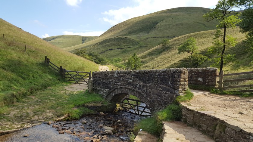
Anyway… back to our day long adventure… With Mark leading the way he took us up towards the plateau… that is all I can say… Mark has years of mountain and trekking experience and outdoor survival skills so we always feel in safe hands. He led us off the beaten path and the four of us scrambled up some random hill where we could just about make out a footpath! I therefore have no idea which route we took! We followed the pretty stream up hill as we climbed through the emerald green foliage for about 45 minutes until we came to the Kinder Plateau and were rewarded with beautiful views.


While we love trekking through this gorgeous scenery, Chris and I are by no means experts! We rely on people like Mark to led the way and are somewhat lazy as we obediently follow along behind him. We realised we should start to become more independent and learn how to read maps properly and have since done the occasional hike by ourselves.

We made our way along the plateau towards Kinder Scout, which at 636 m is the highest point of the Peak District. Up until 1932 Kinder Scout was closed to walkers until a protest known as the Kinder Scout Trespass took place. Three groups of walkers approached Kinder Scout to demonstrate against the lack of access to these areas of natural beauty.

If you venture through them the Kinder Scout peat bogs make your trek an adventure in itself and certainly add a bit of excitement to the day! With Mark leading the way we crossed the weird boggy landscape which sits at the top of the moorlands.


After a couple of hours of trekking around the peat bogs, as part of our circular route we took a different way for the descent.

Jacobs Ladder is a series of steep stone steps which lead you back to the village of Edale.


At the end of the walk we drove to Hathersage and what better way to end a fabulous day than with a fabulous curry in Sangams Indian restaurant!
There is a great deal of online information on trekking in the Peak District with maps and routes and tips and guidance in abundance. Kinder Scout can, however, be a dangerous place to explore for a number of reasons.
The weather can be changeable, as we found when we did a similar hike in August 2014 when we had hailstones stinging our faces and wind so strong we could hardly stand upright.
Walkers have been known to become stuck in the peat bogs. And there are the usual hazards associated with hill trekking and mountaineering such as falling over and twisting or breaking something and even worse… So please don’t under estimate your abilities if you are planning such a trip.
I think the route we took was a variation of this: https://www.nationaltrail.co.uk/sites/default/files/walk_50.pdf

3 comments